In
terms of the DEA&DP Visual Guidelines,
the following mitigations can be utilised
to control the degree of landscape
modification.
- Avoidance:
“Consideration should be given
to avoiding potential impacts altogether…”
- Mitigation:
“These may include adjustments
to the siting and design of the
project, the careful selection of
finishes and colours, the use of
earthworks (such as berms) and planting
to provide visual screening, as
well as dust control where required.
Penalties for non-compliance should
be considered.”
- Compensation
and offsets: “Where
avoidance and mitigation cannot
achieve the desired effect, various
forms of compensation could be considered.
These may include land swaps, appropriation
or financial compensation.”
- Rehabilitation
and restoration: “Both
on-site and off-site landscape rehabilitation
of areas affected by the project
should be considered…This
may include re-instating landforms
and natural vegetation, provision
of landscaped open space, or other
agreed upon facilities.”
- Enhancement:
“Where the proposed project
is located in run-down areas, or
degraded landscapes, the improvement
of these areas could form part of
the visual management actions for
the project.”
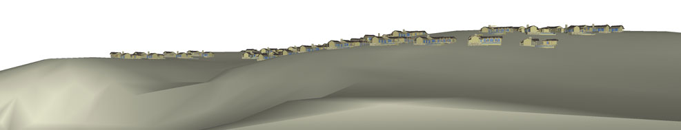
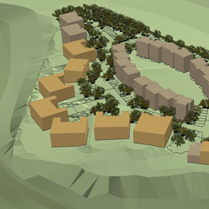
As part of the process of determining
the impact and informing I&APs
of the proposed landscape modifications,
3D modelling and photo montages are
used to represent the proposed modifications.
VRM Africa has adopted the modelling
ethics drawn up by the Collaboration
of Landscape Planners who state that
“Professional preparers and
presenters of realistic landscape
visualisation are responsible for”:
- Promoting full understanding
of proposed landscape changes
- Providing an honest and neutral
visual representation of the expected
landscape by seeking to avoid bias
in responses and demonstrating the
legitimacy of the visualisation
process.”
- Represent typical or important
views
- Provide viewers with a wide range
of viewing conditions (including
worst-case conditions)
- The visualisation should be defensible
by following a consistent and documented
procedure
In order for the above guidelines
to be implemented, VRM makes use of
the latest technological advances
in 3D GIS to ensure realistic, real
time representations of proposed landscape
changes. It is important to note that
although all technological advantages
have been utilised in order to create
a realistic representation of proposed
or potential receptor views, they
are an approximation and therefore
must be referenced as FOR ILLUSTRATIVE
PURPOSES ONLY.
3
|